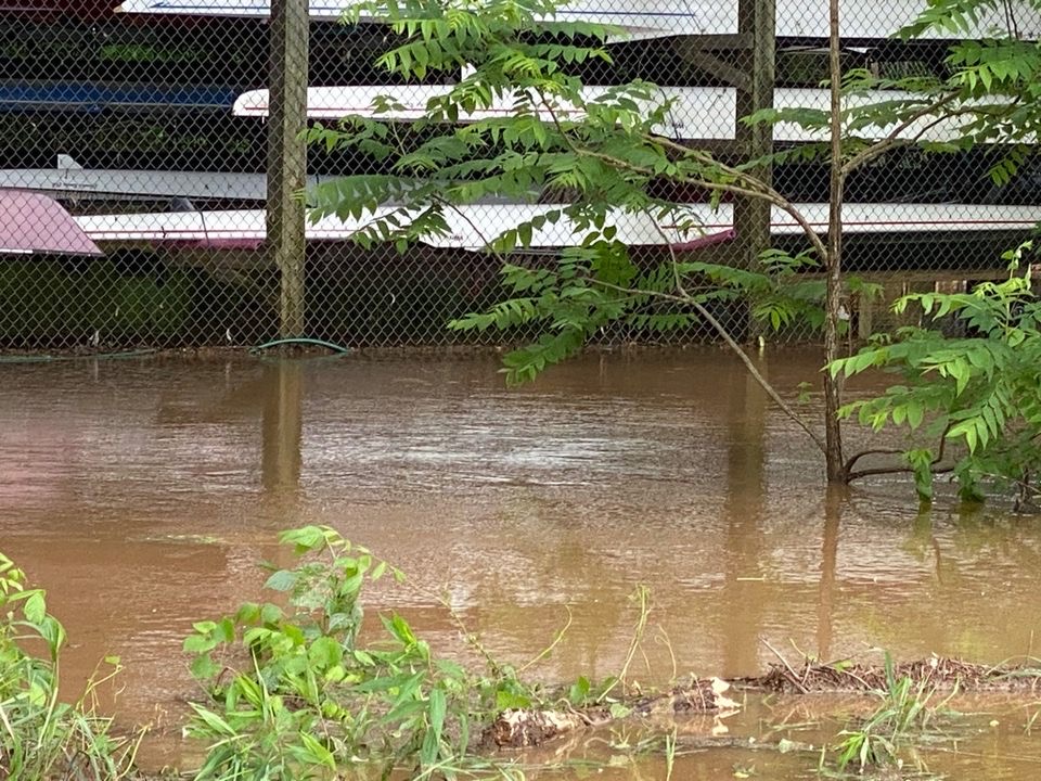
-
- This map shows, cities (black), water (blue), water stations (red), the 3 river basins (green), and their boundaries (yellow).
-
- Click on the red dots to open a water station. A new window shows the most current data for gage height and discharge (if applicable).
-
- The most interesting water station for our club is at the dam of Parr Lake near Alston, SC.
-
- During the floods in spring 2003 the water needed about
- 5 hours from Alston, SC,
- 21 hours from Carlisle, SC, and
- 46 hours from Blacksburg, SC to our boathouse.
- During the floods in spring 2003 the water needed about
-
- To estimate the gross amount of water that will arrive in Alston, SC add the discharge of the following stations:
-
- To determine the current level of the water at our dock go to the following links:
- Broad River at the I-20 Bridge, Columbia, SC A monitoring station installed at the I-20 bridge, just upstream of the dock, gives us real time data on several parameters including the river level, flow rate and temperature. At 153.55 ft., water is even with the top of the diversion dam. At 157 feet, the ramps to the dock are almost horizontal. Any level over 158.5 feet is going to get the floor of the boathouse wet.
- If the I-20 station is down, one can determine the approximate temperature of the river by going to the following link: Broad River Temperature near Jenkinsville, SC.
- To determine the current level of the water at our dock go to the following links:
Remember that \”a reasonably fit person has a 50% chance of surviving a 50 meter swim in 50 degree water\”. If you fall out of your boat, get out of the water as soon as possible, even riding your shell like a surf board to the bank.
- If the water level drops under 150 ft the gas pipelines upstream become a water hazard. Here is a picture of the pipelines at 48.5ft taken in August 2007 (148.5 ft with today\’s calibration).
Here are the effects of different water levels of the Broad River.
Current weather radar image of the upper Broad River Basin:
The area Columbia-Newberry-Greenville-Ashville-Hickory-Columbia describes the bounderies of the three river basins described above.
Click here to see a prediction of the Broad River water level at Blair, SC.
Current River Forecast for the upper Broad River and other SC rivers:
In case of normal water levels: look for PARR SHOALS. The last three numbers is the estimated amount of water (cubic feet in thousand) at the dam of Parr Lake near Alston, SC for the following days.
In case of a flood: Look for PARR SHOALS INFLOW (the third last). The number \”:0215:\” stands for the date \”Feb. 15\”. The following numbers is the estimated amount of water (cubic feet in thousand) at the dam of Parr Lake near Alston, SC for the following days.
water level* | place | observation |
34000 | boathouse: | ? Water reaches to the front right corner |
37500 | boathouse: | ? Water reaches to the first middle post ? Only the right side under water |
38500 | boathouse: | ? Right side about 15cm under water ? Most of left side under water ? Front left corner dry for about 2m in both directions |
roads: | ? Area behind boathouse all the way to the gravel road under water | |
44000 | dock: | ? Water all the way up to the tip of the bollard for the dock trusses (50cm) ? Platforms in front of ramps about 5cm under water ? Ramps tilt up slightly |
boathouse: | ? Front right corner about 35cm under water ? Front left corner about 15cm under water ? Handles of sweep oars in the water |
|
roads: | ? The highest point between boathouse and dock still above water ? The lowest point between boathouse and dock about 45cm under water |
|
52000 | dock: | ? Ramps point upward ? Platform in front of ramps about 20cm under water |
boathouse: | ? Front right corner about 50cm under water ? Front left corner about 30cm under water ? Ramps in the back start to float ? Current through boathouse clearly visible |
|
roads: | ? The lowest point toward the boathouse about 30cm under water (for cars impassable) ? Road right next to left corner of the boathouse about 10cm under water |
|
57000 | dock: | ? First balusters of railings at the ramps half under water (40cm) |
boathouse: | ? Front right corner about 75cm under water ? Front left corner about 55cm under water |
|
roads: | ? Posts at the chain gate about 25cm deep ? Parking area next to hootie house about half under water (diagonally) ? The lowest point toward the boathouse about 50cm under water ? The lowest point between boathouse and dock about 70cm under water ? The highest point between boathouse and dock about 5cm under water |
|
94000 | dock: | ? Hand rails at the ramps half under water (90cm) |
boathouse: | ? Front right corner about 130cm under water ? Front left corner about 110cm under water |
|
Road: | ? The lowest point between boathouse and dock about 120cm under water ? The highest point between boathouse and dock about 55cm under water ? The lowest point toward the boathouse about 100cm under water ? Posts for the chain gate about 80cm deep in the water (nearly up to the hole) ? Parking area next to hootie house all the way to the canoe sign under water ? hootie house surrounded by water ? Current in front of hootie house running off driving range |
This table describes my (Henning Liese) own observations during the floods of 2003 & 2004. Please consider that there is still a level of error due to the fact that the speed of the flow is different depending on the water level.
*= amount of discharge in qft/sec at ALSTON, SC about 5 hours before observations at boathouse) The club is blessed to have some of the best rowing conditions you can imagine: